The Ministry of Natural Resources and Forestry – Parry Sound District is advising area residents that a Watershed Conditions Statement – Water Safety is in effect for the District which includes the District Municipality of Muskoka, the Territorial District of Parry Sound and a north-west portion in the County of Haliburton.
Higher than normal water levels and flow conditions are anticipated following precipitation moving through the area which are forecasted to drop 25-75mm of precipitation on Friday through to Saturday evening. Residents are reminded to keep a close watch on conditions and regularly check for updated messages.
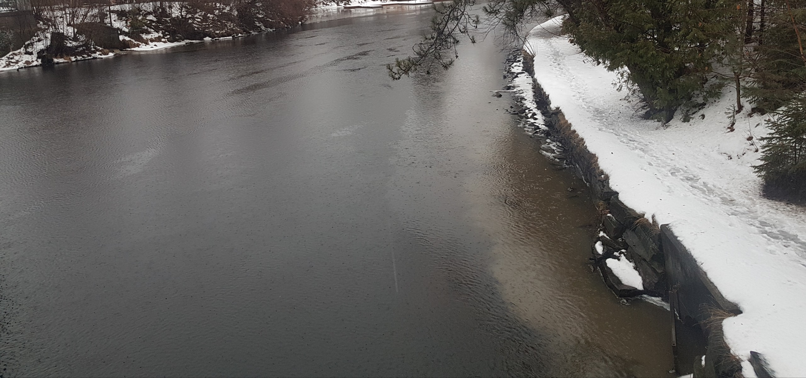
With cooler temperatures, banks and shorelines adjacent to water bodies can be extremely slippery and unstable. Residents and visitors should exercise caution while around water bodies and maintain close supervision of children and pets. Sudden increased lake levels may result in ice conditions to deteriorate on local lakes. MNRF also advises extreme caution when using forest access roads for outdoor activities as many are seasonally inundated with water, prone to washouts and may be impassible due to localized flooding.
Freezing rain, ice pellets or snow will continue Saturday night before coming to an end Sunday morning. Ice accretion is likely for areas that receive mostly freezing rain.
Travel will be impacted throughout Southern Ontario Saturday into Sunday.
Water levels in many lakes in the area are low or at their seasonal levels for this time of year. Water levels started to lower with colder temperatures in December and have remained low into January. Current snowfall amounts average 15-20cm and have the capacity to absorb some of the rainfall, but water levels and flows are still expected to increase from their current levels to various degrees with incoming precipitation in the forecast.
…as temperatures return below the freezing mark, inputs from melting snow will slow and water levels and flows will begin to recover from the additional inputs from local precipitation and snowmelt.
MNRF is closely monitoring the weather and developing watershed conditions. Further updates will be issued as appropriate.
Don’t miss out on Doppler!
Sign up here to receive our email digest with links to our most recent stories.
Local news in your inbox three times per week!
0 Comments