Having grown up in Huntsville, the “Spring Freshet” is not a new phenomenon. We experience this every few years depending on how much snow is in the bush, how quickly it melts, and how much spring rain we get before it’s gone. While this is horrible for the local businesses located in that area, when you build a town on a river, periodic flooding like this is to be expected. This is why the parking lot near the current Boston Pizza is locally known as “Beer Lake.” I remember as a kid living out near Buck Lake when the dirt road used to be so muddy that we had to walk half a mile to get to our vehicle just to go to school or town.
For those who have moved to the area recently, the science behind our floods comes down to a volatile mix of timing and capacity. Statistically, Huntsville is seeing more “extreme rain events” during the thaw, which, when combined with a “late thaw” (delayed into late April), creates a dangerous scenario where snow melts rapidly under a stronger sun just as heavy rains hit. This is compounded by “watershed saturation”—if a wet autumn or mid-winter melt has already filled the ground’s “sponge,” nearly 100% of the runoff flows directly into our lakes and rivers, leaving the water with nowhere to go but up and over our banks.
Here’s a look back at the previous times Huntsville has faced a major flood:
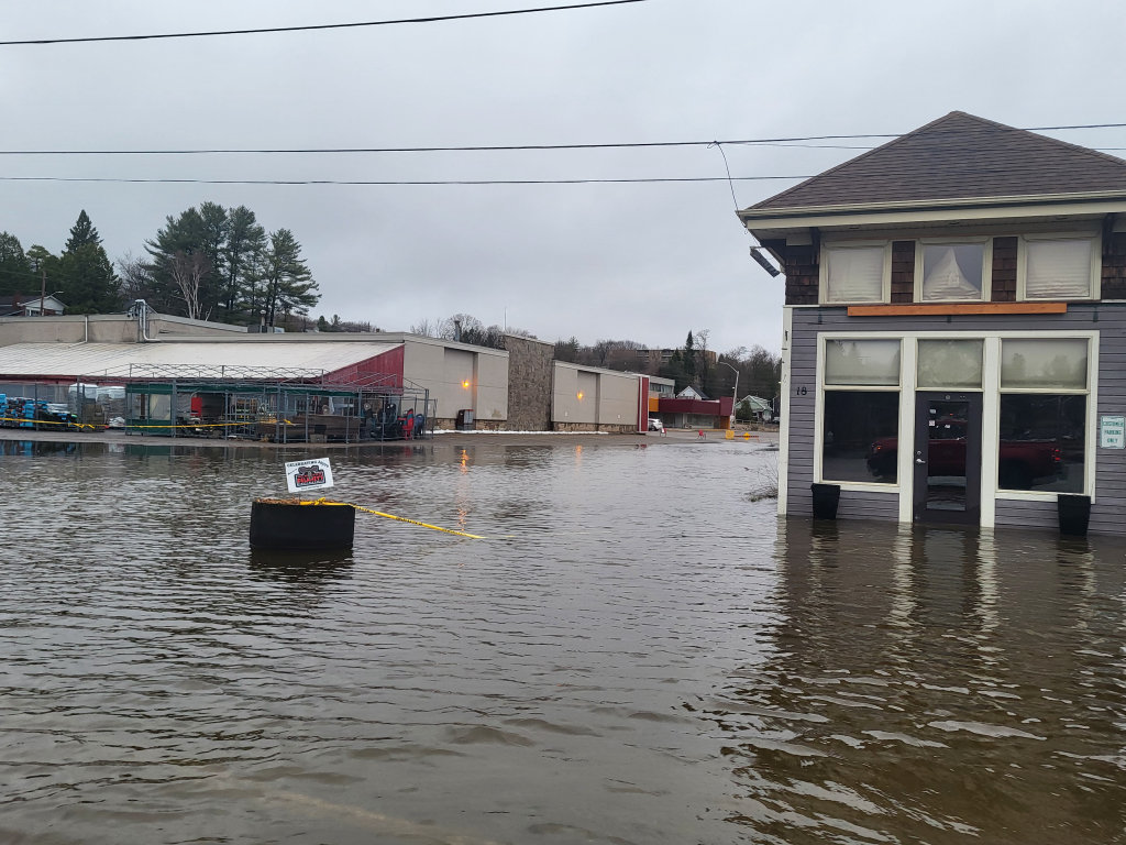
- 2026 (Current): “Beer Lake” is back—the low-lying area near the Main Street bridge and the Town Dock is under significant water. Major closures include Town Dock Park, Hunter’s Bay Trail, and Avery Beach. Roads like Cann St., Dyer Memorial, and Old North Road are currently underwater.
- 2023: A moderate flood event. While not as severe as the record years, several low-lying roads were closed and the MNR issued significant flood warnings.
- 2019: THE RECORD BREAKER. The most devastating flood in Huntsville’s history. A State of Emergency was declared as water levels surpassed 2013 records. Widespread damage to downtown businesses and rural infrastructure.
- 2017: A high-water year that saw regional flooding across Muskoka, putting the town on high alert following a very wet spring.
- 2013: THE “CENTURY” FLOOD. Before 2019, this was the benchmark for disaster. A State of Emergency was declared as the downtown core was inundated and many boathouses on the Big East River were partially submerged.
- 2008: A significant flood year that caused major damage to docks and waterfront properties, serving as a wake-up call for modern floodplain mapping.
- 1998: A rapid spring thaw led to localized emergencies and road washouts across the district.
- 1980–1985: Multiple “high water” years occurred in this window, with 1980 in particular causing significant dock damage and flooding in Port Sydney.
- 1976: Historically noted as one of the major “Regulatory Floods” used by engineers to study water flow in the Muskoka River system.
- 1928–1960: Major flood events were recorded in 1928, 1947, and 1960, back when logging was still a primary industry on the river.
Stay Safe, Huntsville! You just need to take it a day at a time. The flood waters will soon be gone and life will return to normal.
Dr. David Speicher.
Dr. David Speicher is a former Huntsville resident and Huntsville native whose local roots run deep; he grew up attending Pine Glen Public School and HHS, and his family has called this area home for over 200 years.
Don’t miss out on Doppler!
Sign up here to receive our email digest with links to our most recent stories.
Local news in your inbox so you don’t miss anything!
Click here to support local news
A bit of clarity, 2013 was higher in Huntsville than 2019. 2019 was much worse from Mary Lake down the watershed. 2019 stayed at a high level for several days which caused the significant increase in volume. Control of building in the flood zones is pretty good but some people persist in ignoring it and mother nature will remind them soon enough.
When seen in black and white, one can conclude the flooding has become much more frequent. Using today’s building codes I wonder if the extensive development would happen on what, ostensibly, is a till (flood)plain or wetland “sponge” (see, Mr. Snelson, I was paying attention in your class!) around our lovely Muskoka River. Instead we have the infamous “Beer Lake”. Thank you David for your insightful, accurate research!
There , but for a lake , a Thursday lunch at Moose Delaney’s!
Thank you for the good reminder and factual flood details. Every year the flooding feels ‘unprecedented’ but as your statistics demonstrate…it’s not. In fact spring flooding is quite predictable and reasonably manageable in most years.
We can see the Lookout from the end of our driveway. As my husband often jokes, “When water reaches our garage ,it’s time for another ark-building!”