With temperatures over the next seven days expected to remain near seasonal, with daytime highs up to +13°C and nighttime lows down to -1°C and up to 38 mm of rainfall forecasted, the Ministry of Natural Resources has issued a Flood Watch bulletin for Muskoka River watersheds.
This advisory remains in effect until Friday, April 25, 2025.
The Flood Watch will affect residents within the MNR Bracebridge-Minden-Parry Sound District, which includes portions of the District Municipality of Muskoka, and the County of Haliburton.
Residents should expect water levels and river flows to remain high through the April 18-20 long-weekend and into the week of April 21-25.
Runoff into local lakes and rivers is anticipated to increase with forecasted rainfall, snow melt and warm weather.
MNR advises residents to exercise extreme caution concerning ice conditions. No ice is safe ice. High water levels combined with a forecast for high winds has the potential to damage shoreline infrastructure due to moving ice.
MNR also advises extreme caution when using forest access roads for outdoor activities as many are seasonally inundated with water, prone to washouts and may be impassible due to current water levels.
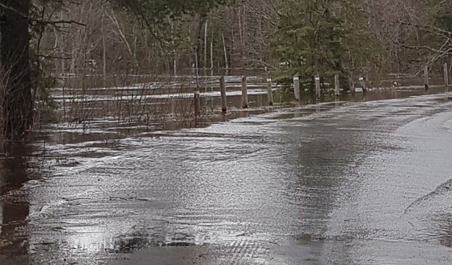
Lower-lying portions of known flood-prone areas will be impacted to varying degrees as lake and river water levels remain high in response to recent and forecast precipitation and melting snow in the coming week. Residents and visitors should exercise caution while around waterbodies and maintain close supervision of children and pets.
Residents who have been affected by high water and flow conditions in the past should continue to take necessary action to protect/secure any vulnerable property in proximity to rivers and lakes and closely monitor developing conditions and regularly check for updated messages.
The ministry is closely monitoring the weather and developing watershed conditions. Further updates will be issued as appropriate.
TECHNICAL INFORMATION
Description of Weather System
Temperatures over the next 7 days are expected to remain near seasonal with daytime highs up to +13°C and nighttime lows down to -1°C. There is up to 38 mm of rainfall forecasted.
Description of Current Conditions
Lake water levels are generally stable and river flows have been variable over the past week. Some snowpack remains across the watersheds with increased runoff from snowmelt anticipated.
Ice on local lakes and rivers is unsafe and is breaking up. High winds combined with high water levels have the potential to damage shoreline infrastructure due to moving ice.
DEFINITIONS
• FLOOD WATCH: potential for flooding exists within specific watercourses and municipalities.
Don’t miss out on Doppler!
Sign up here to receive our email digest with links to our most recent stories.
Local news in your inbox so you don’t miss anything!
Click here to support local news
0 Comments