The Ministry of Natural Resources – Bracebridge-Minden-Parry Sound District is advising area residents and visitors that a Flood Warning is in effect in the district until Wednesday, April 22, 2026.
This message will affect residents within the MNR Bracebridge-Minden-Parry Sound District for portions of the District of Parry Sound, District of Muskoka, and County of Haliburton, within the Severn, Boyne, Burnt, Gull, Pickerel, Seguin, South, Magnetawan, and Muskoka River Watersheds.
The 7-day weather forecast predicts daytime highs of 3°C to 20°C and overnight lows of -4°C to 10°C, with up to 65 mm of rainfall.
River levels and flows within the district remain elevated – particularly in the Gull and Moon River.
Lake water levels in several areas are approaching the upper limits of their normal operating ranges and are expected to continue rising.
Additional precipitation and warmer temperatures are forecasted.
Snowpack remains present and represents an ongoing source of runoff.
Locations of particular concern due to the potential for heightened impacts include:
• Gull River in the Town of Minden
• Moon River, including the Bala Reach
Residents and visitors should expect lake water levels to continue to rise and river flows to remain high throughout the week of April 13-17 and into the weekend of April 18-19.
Runoff into local lakes and rivers is expected to increase due to recent rainfall, with additional forecasted precipitation and warming temperatures contributing to higher lake water levels and river flows.
MNR advises residents to exercise extreme caution concerning ice conditions. No ice is safe ice. Some lakes within the area are still covered in ice. Increased water levels and precipitation may erode the ice and create floating ice hazards that could damage waterfront infrastructure. Anyone planning to venture onto the ice should check the ice conditions often, plan ahead, and be prepared for an emergency.
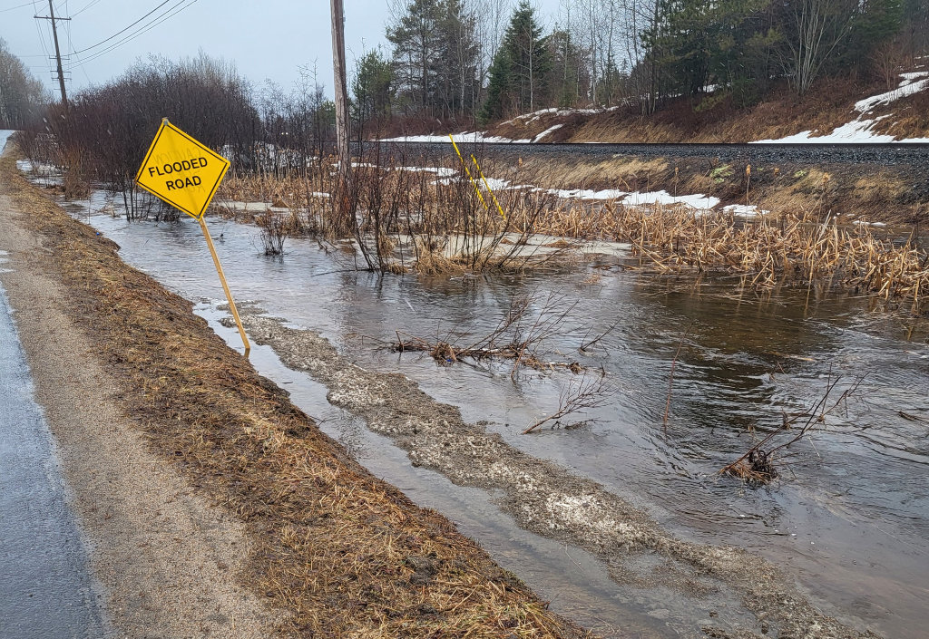
MNR also advises extreme caution when using forest access roads for outdoor activities as many are seasonally inundated with water, prone to washouts, and may be impassible due to current water levels.
Higher-than-normal water flow conditions are occurring throughout the area due to recent rainfall and snowmelt. Slippery stream banks and fast-flowing, cold water will create hazardous conditions around all water bodies. Residents are reminded to keep a close watch on weather conditions, regularly check for updated messages, exercise caution near fast-moving rivers and streams, and maintain close supervision of children and pets.
Residents who have been affected by high water and flow conditions in the past should continue to take necessary action to protect/secure any vulnerable property in proximity to rivers and lakes, and to closely monitor developing conditions.
Lower-lying portions of known flood-prone areas may be affected to varying degrees as rainfall and melting snow runoff enter watercourses.
The ministry is closely monitoring the weather and developing watershed conditions. Further updates will be issued as appropriate.
Definition
• FLOOD WARNING: flooding is imminent or occurring within specific watercourses and municipalities.
Don’t miss out on Doppler!
Sign up here to receive our email digest with links to our most recent stories.
Local news in your inbox so you don’t miss anything!
Click here to support local news
0 Comments