The cause of damage from a July 15 storm in the Dwight area has been confirmed as a tornado by the Northern Tornadoes Project (NTP).
Lesley Elliott, research meteorologist with NTP, said that the team prioritized the area for satellite review yesterday. Imagery revealed a tornado damage path starting near North Portage.
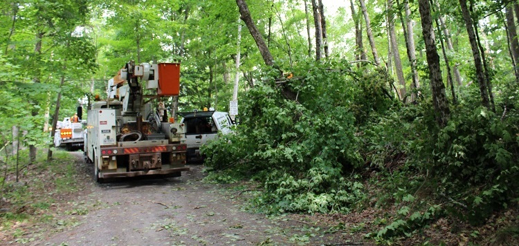
“Preliminary damage assessment is EF2, with an estimated max. wind speed of 190 km/h, track length of 4.76 km and max. path width of 360 m. Tornado motion was from the SW (approx. 235 degrees),” she wrote in a message to Huntsville Doppler. Wind damage is measured using the Enhanced Fujita (EF) Scale, which rates the intensity from EF0 (weakest) to EF5.
The tornado caused significant tree damage along Wolf Bay Road, extending northeast along the South Portage Road corridor.
It was one of five different tornadoes documented by NTP in Ontario on July 15. The others were in Barrie, Zephyr, Lorneville, and Lake Traverse.
Last week’s storm track through the Dwight area isn’t far from the damage caused on June 10, 2020 when a tornado travelled from the eastern shore of Mary Lake to northeast of Dwight.
Earlier in the week, another severe wind event caused damage in the Tasso Lake area on July 13. That event is still under investigation, but preliminary assessment suggests it was caused by a downburst.
Don’t miss out on Doppler!
Sign up here to receive our email digest with links to our most recent stories.
Local news in your inbox so you don’t miss anything!
Click here to support local news
0 Comments