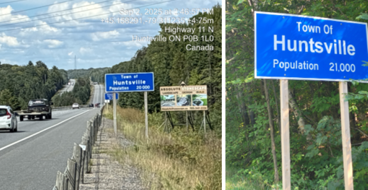
Photo: The population sign on the left is on Hwy. 11 northbound and controlled by the MTO while the one on the right is on Muskoka Rd. 3 on a District of Muskoka Road.
If population signs for Huntsville are throwing you for a loop, that’s because different entities manage them.
First, there are the population signs on Ontario Ministry of Transportation (MTO)-controlled highways. There are two population signs on Highway 11 southbound and northbound, showing Huntsville with a population of 20,000.
Doppler reached out to the MTO to find out how the signs get updated and received the following statement: “Population figures displayed on signs along a provincial highway are based on census data published by Statistics Canada and are updated when requested by the municipality,” according to Julia Caslin, Senior Media Relations Advisor. “Population signs on roads that are not under provincial jurisdiction would be the responsibility of the local road authority,” she added.
Then there are the District of Muskoka-controlled population signs. The sign below is located on Muskoka Road 3, between the Rosseau and Huntsville boundary line. It shows Huntsville’s population at 21,000.
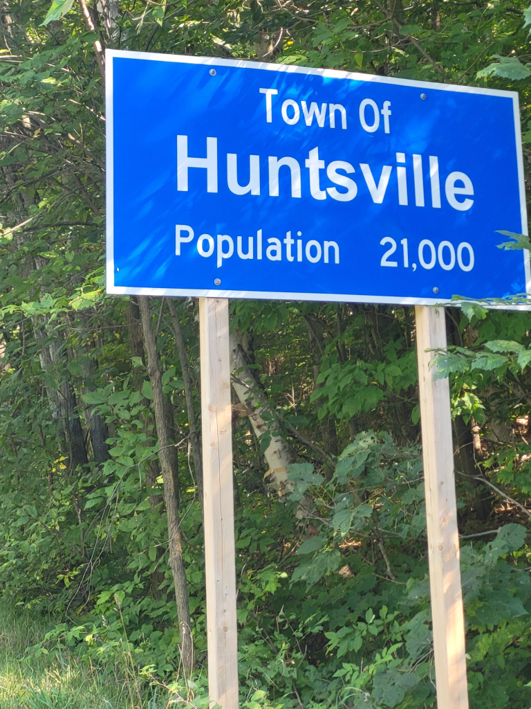
According to Huntsville Economic Development Officer, Lauren MacDermid, the District of Muskoka updated population signage on District-owned roads in 2023 using Statistics Canada data. The signs can be found at Muskoka Road 2 at Stisted Road South, and Muskoka Road 3, between the Rosseau and Huntsville boundary line.
MacDermid explained that the remaining population signage is administered and controlled by the Ministry of Transportation (MTO). “The signs are revised every five years in accordance with the MTO’s rules and regulations, using the most recent census data. The next census is slated for May 2026, after which the signs will be updated by the MTO.”
Additional Info:
- Residents interested in updated growth information can explore Huntsville’s demographics and statistics using the community profile tool on the Town’s website here: Community Profile and Demographics | Town of Huntsville . The tool pulls from the most recent Statistics Canada data.
- To gauge development in the Town of Huntsville, view the number of building permits issued here: Permits Issued | Town of Huntsville.
Census Summary Table
| Census Year | Population | Change |
|---|---|---|
| 2016 | 19,816 | — |
| 2021 | 21,147 | +1,331 (6.7% increase) |
Town of Huntsville’s Housing Needs Assessment (2024)
A report presented to Huntsville Council in December 2024 by Tim Welch Consulting predicts that Huntsville’s population will increase from 21,147 in 2021 to approximately 29,600 by 2031.
Again, the 2026 Census of Population is scheduled for May 2026.
Don’t miss out on Doppler!
Sign up here to receive our email digest with links to our most recent stories.
Local news in your inbox so you don’t miss anything!
Click here to support local news
I hope there aren’t to many people are upset about the signs.If they want to be upset about something take a walk down the pathways behind Metro Grocery Store.
MTO also incorrectly labels Penfold lake as Siding lake on Hwy 11 south of Huntsville. Siding lake is kilometers away.
The question I’d ask is why do we care about putting population data on a road sign in the first place, especially in this age of cell phones and internet.
Of more interest would be to note somehow on the sign that the placement of the sign does not actually indicate the “built up” part of the town but rather the somewhat hard to comprehend (at least to a visitor) legal boundary arbitrarily set up for the town. This is a pretty artificial boundary that bears little relation to the actual “town” as one would normally expect.
There are other questions I wonder about.
Like why did Lake of Bays township spend over $50,000 taxpayer dollars to install signs for Hillside, Dorset, Baysville and Dwight on the Provincial highways, nice signs, very artsy and all that but an exact duplication of the signs already in place and provided by the MTO? This accomplishes exactly what? There was this cost to install, there must be a cost to maintain and I assume that the Township must have paid MTO and is continuing to pay yearly, (someone please check this out for me!) for these sign sites, the same as every other roadside sign.
Like most things government there seems to be a lack of coordination, agreement and need between the various levels. The effort could be better spent elsewhere.