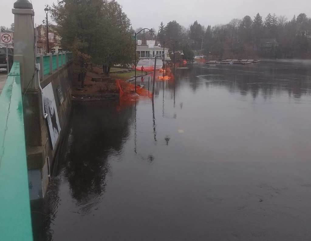
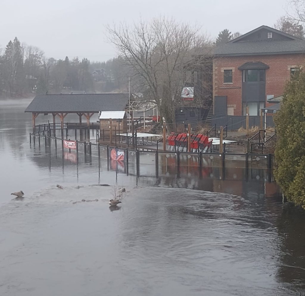
The Town of Huntsville is strongly advising property owners and businesses in flood-prone and low-lying areas throughout the community, especially in the downtown core, to take the necessary precautions to protect and secure their property in anticipation of additional forecasted rainfall that will flow through the water system.
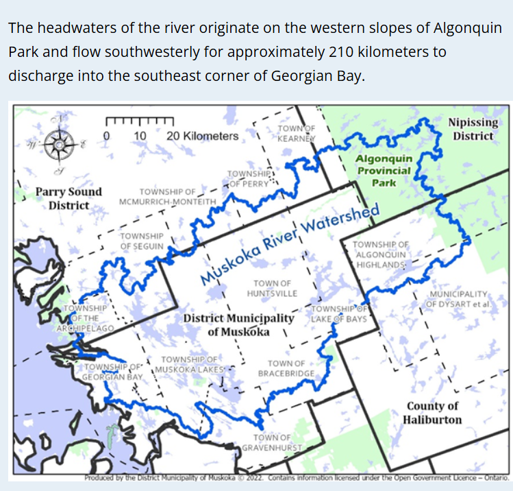
Water flows from the western slopes of Algonquin Park through Huntsville, Ontario, primarily through the Big East River, which travels through Chaffey Township and Arrowhead Provincial Park before entering Lake Vernon. From there, the water joins the North Branch of the Muskoka River system, flowing through Fairy Lake and Peninsula Lake, travelling south through Port Sydney towards Bracebridge, where it joins the Muskoka River system.
The Muskoka River is comprised of three subwatersheds: the north and south branches of the Muskoka River, and the Lower Muskoka subwatershed, comprised of the Musquash/Gibson River and Moon River. There are a total of 41 water control structures located throughout the river, including 11 waterpower facilities and 30 dams. The Ministry of Natural Resources (MNR) owns and operates 29 of these dams, according to the Lake of Bays Heritage Foundation’s website. You can find more information about the watershed on the Muskoka Watershed Council website.
The Township of Lake of Bays has also been affected by flooding, overwhelmed culverts and road washouts.
Municipalities in the Almaguin Highlands region have issued special weather statements, with the Magnetawan River breaching its banks in some areas and snowmelt and rain causing flooding and road closures across the region.
More rain is anticipated in the forecast, and residents are asked to take precautions.
Residents are reminded to stay clear of flooded areas, fast-moving water and any spring ice (no ice is safe ice). Parents and guardians are also advised to remind children to stay clear of open waters, creeks, and rivers.
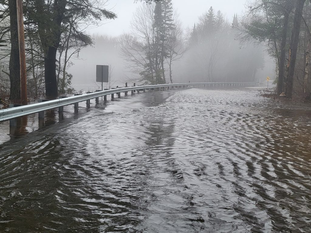
Flooding on some roads is occurring, and signage and barricades have been put in place. Do not attempt to drive through flooded roadways. Even shallow water can be dangerous and may hide washouts or debris. Obey all posted road closure signs and barricades.
Road closures in Huntsville:
- Old North Road from civic address 137 to Fowlers Road
- Silver Sands Road at civic address 58
- Dyer Memorial Road
Road cautions (water on road):
- Harp Lake Road at Ena Drive
- Old Muskoka Road
- Sam English Road
- Whitehouse Road
- Rockhaven Road
- Glen Acres Road
- Stephenson Road 12 West
Public Works crews will be prioritizing flood response for the duration of the event and are out assessing and repairing damaged roads.
The Town of Huntsville and MNR Officials will continue to monitor conditions and provide updates as required. Residents are encouraged to monitor local media outlets, the MNR and the Town of Huntsville website for updates. Floodplain maps are available on the District of Muskoka’s website.
Don’t miss out on Doppler!
Sign up here to receive our email digest with links to our most recent stories.
Local news in your inbox so you don’t miss anything!
Click here to support local news
0 Comments