Provincial Flood Watch for Southern and Northeast Region, Issued March 3, 2025, at 11:00 AM
MNR Districts
Aurora Midhurst Owen Sound, Aylmer Guelph, Kemptville Kingston, Minden Parry Sound Bracebridge, North Bay, Pembroke, Peterborough Bancroft, Sault Ste Marie Blind River, Sudbury
Weather situation
An incoming series of low-pressure systems are forecast to move into Southern and Northeastern Ontario on Tuesday, bringing rain and snow, and temperatures well above freezing before moving eastward late Wednesday.
Precipitation is expected to begin overnight Monday in Southwestern Ontario and spread eastward and northward through the day, initially as flurries, but changing over to periods of rain.
On Tuesday, areas west of Owen Sound and Long Point, through Muskoka, and across the North Channel from Sault Ste Marie to North Bay can expect 10 – 15 mm of rain, while the remainder of Southern Ontario can expect 5 – 10 mm of rain. Temperatures are expected to be a few degrees above zero from Sault Ste. Marie across to North Bay, but may reach +10 deg.C in the Sarnia – Windsor area. Most of the Southern Region will see temperatures between +3 to +8 deg. C, with overnight temperatures remaining above freezing.
Rain is expected to continue through Wednesday, with accumulations between 10 – 15 mm for southwestern Ontario, and 15 – 25 mm for the rest of the Southern Region. Precipitation is likely to be a mix of rain and snow across the southern Districts in the Northeast Region, with accumulations expected between 10 and 20 mm.
Temperatures across the Southern Region on Wednesday are forecast to be between +5 and +10 deg. C, with overnight temperatures dropping below zero Wednesday night in the western half of Southern Region as the systems move into Quebec.
On Thursday, lingering precipitation in the form of snow or mix of rain and snow in the east is expected across Southern Ontario, with trace amounts expected. A return to zero or sub-zero temperatures is forecast across the Southern Region.
Risks
Some areas of Southern Region currently have a deep snowpack with higher-than-average snow-water equivalent.
In the mid-February assessment, snow depths range from a few centimetres in far southwest Ontario, to as deep as 80 to 100 cm in the Bruce Peninsula, Collingwood towards Minden, Bracebridge, and Muskoka.
The snowpack is holding significant amounts of snow-water equivalent (SWE) with the highest values ranging from 150 mm to over 250 mm along the Georgina Bay coastal watersheds, Lake Simcoe, and Mississippi Valley watersheds.
The density of the snowpack is increasing, with the highest reported densities of 33% near St. Thomas on the Lake Erie coast, and greater than 40% in the Mississippi Valley watershed suggesting the snowpack is approaching its water-holding capacity, while other areas report less than 30% density, and can absorb some or all the forecast rainfall.
Warm temperatures accompanied by rain will accelerate the speed of snow melt where there are small snowpacks, and contribute to enhanced runoff and elevate water levels. Some areas may experience an increased risk of ice break-up and jamming, and overland flow.
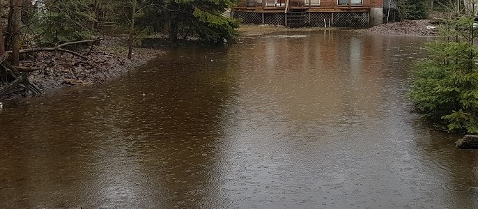
Flooding in low-lying areas and areas with poor drainage is also possible.
A close watch of local weather forecasts, special weather statements and warnings is recommended.
Don’t miss out on Doppler!
Sign up here to receive our email digest with links to our most recent stories.
Local news in your inbox so you don’t miss anything!
Click here to support local news
0 Comments