The Ministry of Natural Resources and Forestry – Parry Sound District is advising area residents that a Flood Watch is in effect for the District, which includes the District Municipality of Muskoka, the Territorial District of Parry Sound and a north-west portion in the County of Haliburton.
A Flood Warning is currently in effect for the Moon River/Bala Reach, the North Branch of the Muskoka River sub-watershed and the South Branch of the Muskoka River.
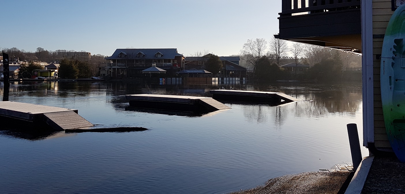
Flows out of Lake Muskoka into the Bala Reach have surpassed the flood warning levels of 280cms and flows will continue to increase as the Lake Muskoka water level rises.
Flows in the North and South Branches of the Muskoka River have surpassed the lower flooding thresholds and are expected to continue to rise with the forecasted precipitation over the next couple days.
All rivers in the District are currently experiencing high flows resulting from thunderstorms and rainfall received last week and over the weekend. The upper watershed is experiencing significant snow melt which is contributing to high levels of water throughout the watershed.
It is expected that lower-lying portions of known flood-prone roads along river courses will be impacted to various degrees as river levels remain high. High water levels in the Huntsville Lakes (Lake Vernon, Fairy Lake and Peninsula Lake) and Mary Lake, typical during the spring, are expected to build and remain high as runoff from rain and continuing snow melt makes its way through the watercourse.
Current water levels and flows are high, due to previous precipitation accumulation and sustained snow melt. The district snow stations have melted, with zero snow at the monitoring stations, however there is still 106mm of snow water content in the upper part of the watershed in Algonquin Park. Snow in the District and in the Park has been melting at a steady rate over the past month, and 80-105mm of rain has been received in various parts of the District since the beginning of the month. These factors have contributed to the river and lake levels increasing steadily.
The current weather forecast calls for daytime highs over the next week to range from 5°C to 15°C, and night time lows to range from -1°C to 5°C, depending on the weather service. Today’s forecast has an expected precipitation range of 5-8mm. Thursday’s forecast has an expected precipitation range of 15- 20mm. Lake and river levels will be expected to continue to increase due to runoff from forecasted rain over the rest of the week and over the weekend.
Residents within the Parry Sound-Muskoka area should keep a close watch on conditions, regularly check for updated messages and exercise caution around water bodies as flows and levels within lakes, rivers and streams remain high. Residents who have a historic susceptibility to flooding should consider taking action to secure or protect any property in flood-prone or vulnerable areas. This may include ensuring sump pumps are functioning and/or securing items along the shore line as water levels rise. Banks and shorelines adjacent to water bodies are extremely slippery and unstable. Residents and visitors should exercise caution while around water bodies and maintain close supervision of children and pets.
MNRF also advises extreme caution when using forest access roads for outdoor activities as many are seasonally inundated with water, prone to washouts and may be impassible due to current water levels.
MNRF is closely monitoring the weather and developing watershed conditions. Further updates will be issued as appropriate.
Don’t miss out on Doppler! Sign up for our free, twice-weekly newsletter here.
A few very short years ago the District/Town spent a lot of money on not only enhancing the look but as or more importantly the drainage in the Cann/John St area. Looks great but at this time of year the drainage does not work.The water is supposed to drain into the river but again at this time of year the river is higher than the drain pipe so the water from the river is forced to flow back up the drain pipe and floods the whole Cann/John area.
A suggestion might be to put a one way check valve in the pipe or just cap the drain pipe at the river until the river goes back down below the drain pipe. I’m sure all the businesses around this area would sleep a lot better at night.
The ice went out of Haystack bay yesterday, April 18. This is about 4 days earlier than the 100 year average and now the water levels are well above normal, but not past the sort of “new normal” for spring floods on Lake of Bays. We seem to get flooding more frequently nowadays than a few decades ago. Also this year the ice did quite a bit of “push” damage in late March, nothing to do with water levels however, just again a bit of an “enhanced normal” if you like to name it.
Personally, I think they should pay waterfront residents an allowance to cover the cost of fixing ice and flooding damage each year and also to help cover the annoyance of being forced to listen to idiots in loud boats with big wakes for the summer months. Then there are Geese too. A protected migrating bird that no longer migrates!!! Progress as they say.