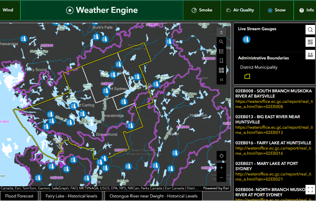
On international GIS Day held on Nov. 19, the work of the shared Huntsville and Lake of Bays GIS team was recognized by ESRI Canada in a video for their innovative Weather Engine map dashboard.
The video highlights the team’s work in consolidating more than 16 data sources into one platform, giving staff, residents, citizen scientists, and emergency response teams access to clear, reliable weather and environmental information in real time.
Esri Canada is a private Canadian company founded in 1984 that provides geographic information system (GIS) software and solutions to businesses, governments, and educational institutions. It helps organizations leverage the power of geography to make informed decisions, manage resources, and plan for the future through mapping and spatial analytics.
See the video below and click here for the GIS Weather Engine Dashboard
From the Township of Lake of Bays
Don’t miss out on Doppler!
Sign up here to receive our email digest with links to our most recent stories.
Local news in your inbox so you don’t miss anything!
Click here to support local news
0 Comments