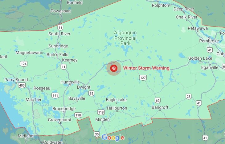
Environment Canada has issued a winter storm warning for Parry Sound and Muskoka.
Hazards:
Heavy snow. Total snowfall accumulations of 15 to 30 cm possible. Peak snowfall rates of 3 to 5 cm per hour. Strong wind gusts resulting in significantly reduced visibility in blowing snow.
Timing:
This evening to Saturday afternoon. Discussion: Snow is forecast to begin this evening and will quickly become heavy at times tonight, before transitioning to periods of light snow Saturday morning. Strong easterly winds gusting up to 70 km/h will combine with this heavy snow to cause significantly reduced visibility at times. In the wake of this system, much colder Arctic air will become established across the region. A multi-day lake effect snow event is expected for locations east of the Great Lakes bringing additional snowfall accumulations to some communities.
Surfaces such as highways, roads, walkways and parking lots may become difficult to navigate due to accumulating snow. Visibility will be suddenly reduced to near zero at times in heavy snow and blowing snow. Consider postponing non-essential travel until conditions improve. Please continue to monitor alerts and forecasts issued by Environment Canada. To report severe weather, send an email to [email protected] or tweet reports using #ONStorm.
Hydro One says it’s preparing for blizzard-like conditions and damaging winds.
Don’t miss out on Doppler!
Sign up here to receive our email digest with links to our most recent stories.
Local news in your inbox so you don’t miss anything!
Click here to support local news
0 Comments